Sequoias -
History
The Giant Sequoias and Ecosystem Management Controversy:
A history of the Giant Sequoia National Monuent
 Giant Sequoias are possibly the largest organisms ever to exist on Earth. (USFS) Giant Sequoias are possibly the largest organisms ever to exist on Earth. (USFS)
|
Chapters
1. Introduction
2. Geologic History
3. Biological History of the Giant Sequoias
4. The First Peoples
5. European Arrival
6. Resistance to Over-Exploitation
7. Federal Land Management Matures
8. 1919-1982
9. Modern Jurisdictional Boundries
10. Current Forest Service Management
11. Conclusion
Introduction
In terms of total volume, the Giant Sequoias are the largest trees, and possibly the largest living organisms, to ever have inhabited our planet. These trees can grow to over three-hundred feet in height and over twenty-nine feet in diameter. Although historical records from the 19 th century contain anecdotes of settlers logging 4,000 year old trees, the oldest officially documented specimen was 3,200 years old when it died. These rare trees, and the sublime and geologically unique landscape that surrounds them, became national icons that inspired America to begin preservation measures. Around the turn of the century, when unbridled and often disastrous resource extraction proceeded at a frenzied pace, simply conserving forests for future timber supplies was itself a novel idea. Yet, the idea of preserving the trees for the trees themselves and for the ability of future generations to share the current generation's experiences of wonder and awe was nothing short of revolutionary. Those who forged this idea invented one of America's most unique contributions to the world.
Geologic History
The Sierra Nevada Mountains have a dramatic and complex geologic history that began about 250 million years ago at the junction of the Paleozoic Era (500-248 million years ago), and the Mesozoic Era (248-65 million years ago). At that time, what is today called the North American Plate began to move westward relative to the Pacific Plate.
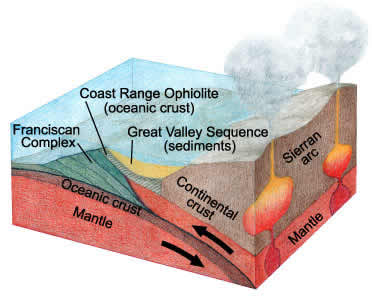
A diagram of the current subduction zone off the California Coast, which resembles what the Sierra Nevada region looked like 250 million years ago. Notice the Franciscan Complex, which is the name given to the accretionary wedge off the coast of San Francisco. (NPS) |
As this happened, the heavier oceanic crust was "subducted," meaning that it was thrust at an angle under the continental crust. During "subduction," as the oceanic crust moves deeper into the earth, the heat and pressure changes the solid oceanic rock into a molten liquid called magma. Several things generally happen during this process. First, much of the sediment overlaying the oceanic crust did not become magma but was instead "scraped" off the subducting crust and formed into a wedge positioned between the continent and the ocean. Portions of this accretionary wedge were exposed to the intense heat the nearby magma generated. Rocks in this wedge that were exposed to the intense heat and altered but remained in a solid state, a process known as metamorphosis, often contain high concentrations of the mineral serpentinite. This mineral gets its name from its smooth texture that feels like a snake skin. [2] Other rocks commonly found in accretonary wedges include chert, greywacke, and basalt. Second, the melting of the oceanic crust increases the total volume of magma stored below the surface. This in turn increases the pressure put on the continental crust. Volcanoes, which are defined as cracks in the Earth's crust that discharge magma to the surface, will form if sufficient pressure exists. If magma reaches the surface, it is called lava. Lava cools rapidly.
In the case of the proto-Sierra Nevada Mountains, this process produced a chain of volcanic islands that were similar to modern Japan. Violent eruptions produce vast empty craters, which are known as calderas. Such eruptions in the proto-Sierra Nevada Mountains produced craters that filled with both terrestrial and oceanic sediments. This process of melting, heating, eruption, and both marine and terrestrial sedimentation continued for tens of millions of years. As a result, a conglomeration of many different types of igneous, metamorphic, and sedimentary rocks made up the surface of the area. Today, portions of these rocks are still present in outcroppings and subsurface strata. Meanwhile, while the surface was experiencing violent and rapid change, a large mass of magma was slowly cooling underneath. Such masses that cool slowly as opposed to on the surface are called plutons. Plutonic rocks have large mineral crystals. The Sierra Nevada region's granite rocks came from this pluton.
About eighty million years ago, the area of magma intrusion shifted to the east because of a change in the angle of plate convergence. The major rock types that exist in the Sierra Nevada Mountains today were present at that time. On the surface, there were the oceanic and terrestrial sediments and various igneous formations. These surface rock types were weathering away, and thus gradually exposing the granite pluton, which by this point had cooled to a solid. About 25 million years ago, the angle of convergence changed again and caused the region's continental crust to stretch and rise. This had two noticeable effects. First, the stretching created scattered volcanic eruptions, especially in the northern portion of the region. Second, the granite pluton began to surface, which created a dramatic slope between its highest point and the surrounding flat land. Why this surfacing happened is not completely understood, but geologists have theorized that the cracking and stretching in the region may have weakened the crust and allowed the pluton, which was being pushed upward by the intense heat of the magma that it was floating on, to break through the surface of the crust. This rise continues today, and the eroding pluton is essentially what makes up the peaks of the Sierra Nevada Range. The eastern slope of the range is one of the most dramatic in the world. The slope on the western side, which is where the Giant Sequoia groves are located, is much gentler. The last noticeable uplift of the pluton occurred during an earthquake in 1872.
During the Pleistocene Epoch, which ended about 12,000 years ago, the temperature of the Earth was significantly colder. Huge glaciers, some having depths of 2000 feet, accumulated near the peaks of the mountains. The downward movement of these glaciers carved out U-shaped valleys like King's River and Yosemite Valleys. In the alpine zone, the glaciers broke off large chunks of rock. This mass wasting left behind cliff-rimmed ridges. Till fields, which are zones at the edge of melting glaciers where chunks of rock accumulate, are still noticeable. The Pleistocene Ice Age was also a key event for the Giant Sequoias, as the epoch's climate worked to restrict the species to its present location.[14]
BACK TO TOP
Biological History of the Giant Sequoias
The closest living relatives of the Giant Sequoias are the Metasequoias of China, and the Redwoods of the northern California and southern Oregon coasts. The ancestors of the species inhabited large portions of the Northern Hemisphere throughout the Mesozoic Era (248 to 65 million years ago) and the Tertiary Period (65 to 1.8 million years ago). However, the development of mountains in western North America has gradually changed the continent's climate. These climatic changes and the evolution of a variety of competitors restricted the Giant Sequoias to scattered groves on the western slope of the Sierra Nevada range.[10]
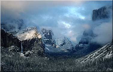
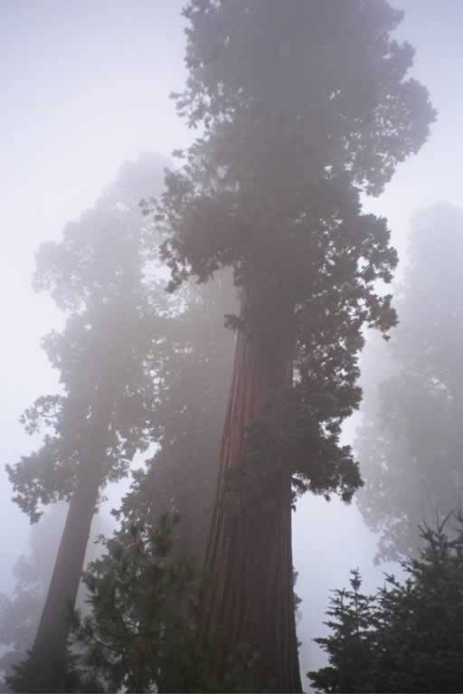
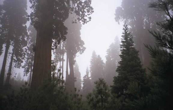
Yosemite Valley Shrouded in Mist. (NPS) |
Neither the cold and lack of oxygen above 8,000 feet nor the heat and lack of moisture below 4,000 feet are tolerable conditions for the Giant Sequoias. The great trees have shallow and fragile root systems, which never go below 4 feet in depth, although they can extend out for an acre. Thus, they can only thrive in areas where the water table is high and ground water is readily accessible. Canyons and slopes seem to supply their preferred microclimates.[13] The soils in the Sierra Nevada region are built primarily on the granite s ubstrate that came from the pluton, yet these trees have been shown to thrive in a variety of different soil types as they are commonly planted around the world as an ornamental species. Research performed by the National Park Service suggests that Giant Sequoia groves, at least for the past several thousand years, have experienced regular occurrences of low-intensity fires. These fires occur on average every 3-8 years, although this interval can vary significantly by location. Additionally, these trees have fire resistant bark which is commonly two feet thick at the base of larger trees.[8] Their seeds germinate best on bare mineral soil, and the saplings require open patches in order to grow well. All of these factors w ould suggest that Giant Sequoias survive best in ecosystems where fire is common.[21] When mature, Giant Sequoias have large buttressed bases that taper towards the crown. The thick, reddish-brown bark is "fluted" with deep ridges. When branches are young, they have a thin layer of gray bark. As these branches grow, they droop until their weight is too great for the branch collar to support, at which point they break off of the tree. Mature trees will often be branchless for the first 80-125 feet above the ground. This adaptation helps to ensure that ground fires will not become crown fires as branches and leaves burn much more readily than the fire resistant bark.[13]
National Park Service land managers have the task of restoring the Giant Sequoia groves to their "natural" state. Debate exists about whether "natural" means the state the groves would be in without any human intervention, or the state they were in before Euro-American settlement. There is evidence from a variety of sources that suggests Native Americans used fire to promote conditions of the forest that were better suited to their lifestyle, as the more "open" forest conditions, which fire promotes, are easier for traveling, hunting, and gathering. However, lightning strikes are naturally abundant in the area. This suggests that weather and fuel conditions are the main determinants of fire frequency. In other words, the fire regimen that existed with the Native Americans in the area was probably not that much different from what it would have been like without humans, as anthropogenic ignition sources are simply not needed for fire to be frequent. [21]
BACK TO TOP
The Southern Sierra Nevada Ecosystem
While the exact details of past fire-frequency remain somewhat ambiguous, the basic structure of the native ecosystem can be gleaned by analyzing sediment samples, historical documents, and current conditions. There are approximately 35,000 acres of groves that contain Giant Sequoias. Several other more common species inhabit these groves. One of these trees is Sugar Pine. The straight trunk and graceful tapering branches of this tree inspired John Muir to call it "the noblest pine yet discovered." For the same reason, the species is also sought for its lumber. Other conifers such as the White Fir, Mountain Hemlock, Western White Pine, and Incense Cedar are common in the 4,000 to 8,000 foot elevation belt, as are broadleaf species such as the Black Oak and Aspen. The mixture of these species results in a tall, multi-layered canopy. Before the age of fire suppression, frequent fires probably created numerous open patches. These patches are necessary for the germination of Giant Sequoia seeds and the existence of the area's early-successional "weed" species.[15]
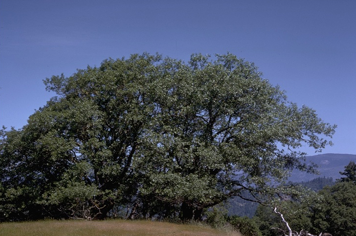
The California Black Oak, a common neighbor of the Giant Sequoias in the 4-8K foot elevation belt. (Berkeley)
|
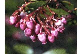
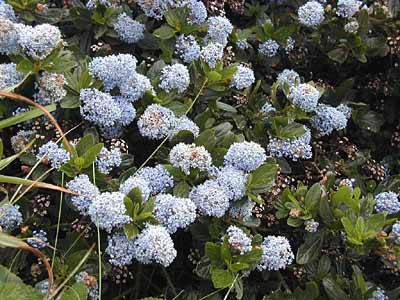
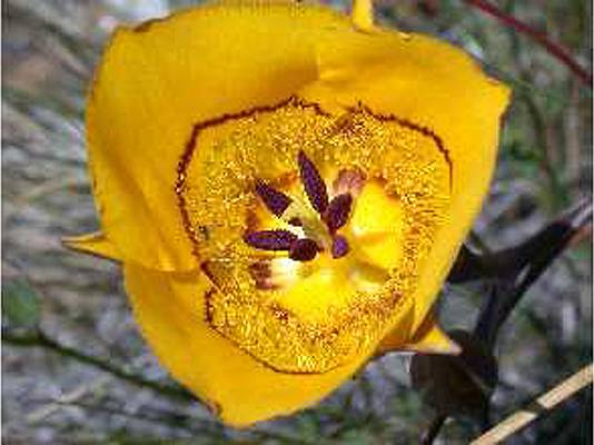
Numerous berry producing shrubs such as the Greenleaf Manzanita, Bitter Cherry, Sierra Gooseberry, Blackcap Raspberry, Thimbleberry, Blue Elderberry, and Snowberry exist alongside Giant Sequoias. Other shrubs such as the Chinquapin and fragrant Ceanothus are also common. Wildflowers like the Mariposa Lily and Azalea exist at lower elevations, as does the Snow Plant, which pops up from the early spring snows. Wild onions such as the Three-braceted Onion and Yosemite Onion used to be much more common, but both are now both classified as rare and occupy only portions of their former range. Other rare species include the Yosemite Wooly Sunflower, Congdon's Lomatium, Slender-stemmed Monkeyflower, Congdon's Wooly Sunflower, and Congdon's Lewisia. The decline of these species can be largely attributed to the rise of invasive or exotic species, which have adaptations that enable them to out-compete the native species. Invasive species are a problem especially in areas that have been affected by human activities such as logging, road building, and cattle ranching, as all three activities both spread seeds and promote conditions that favor the rise of the invasives. Some especially troublesome invasives include the Bull Thistle, Common Mullein, Klamath Weed, Sweet Clover, Himalayan Blackberry, and Yellow Star Thistle. Yellow Star Thistle is particularly disruptive to the native ecosystem as its taproots are able to run deep into the groundwater. This adaptation lowers the water table and makes it more difficult for species dependent on higher water tables, such as the Giant Sequoias, to live.[9]
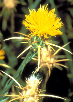
A voracious competitor, the Yellow Star Thistle has taken over entire ecosystems. (NPS) |
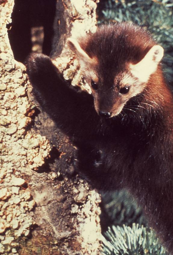
The numbers of virtually every native species of animal have been significantly reduced during the last 150 years of Anglo-American settlement. Some animals, such as the Grizzly Bear and the California Condor, no longer exist in the region. One species that is still common is the American Black Bear, which is considered a harmless nuisance by the area's recreationalists. Other c ommon mammalian species include the Western Grey Squirrel, Mule Deer, Golden-manteled Ground Squirrel, Puma (Mountain Lion), Coyote, and at higher elevations the Pika. Some more rare mammals include the Pine Marten, Badger, Bobcat, Wolverine, Otter, and Fisher. A small number of California Bighorn Sheep are still living at higher elevations. The area's rivers, wetlands, and lakes have experienced an influx of invasive fish species such as the Mackinaw, Brown Trout, and Eastern Brook Trout. This influx has impacted the area's native species, as both the Paiute and Lahontan Cutthroat Trouts are threatened as is the Owen's Tui Chub.[9] Many, if not most, of the invasive fish species were intentionally planted in streams by sportsmen seeking better future fishing opportunities. The area is also home to an assortment of birds such as the Water Ouzel, Clark Nutcracker, Rosy Finch, and Bald Eagle.[15]
BACK TO TOP
The First Peoples
Before the sixteenth century, the area around the Giant Sequoia groves was a convergence point of four distinct cultures: the Owens Valley Paiute, the Yokuts, the Western Mono, and the Tubatulabal. The languages of the Western Mono, Tubatulabal, and Owens Valley Paiute are all part of the Shoshone-Paiute family, which developed amongst peoples who inhabited the Great Basin region. On the other hand, the ancestors of the Yokuts inhabited California for millennia. Their language is described as being Penutian. There is no evidence of any significant warfare between these groups. Indeed, it is clear that trade was common between the Owens Valley Paiute, who lived east of the Sierras, and at least one of the tribes inhabiting the western slopes. Evidence for this trade comes from archaeological excavations that have found shells, acorns, and manzanita berries (all of which must have originally come from the western slopes) in the desert and obsidian, mineral paint, and salt (all of which must have originally come from the desert) in the western foothills.
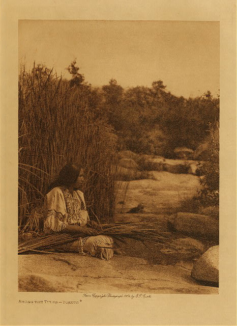
A 19 th century photograph of a Yokuts woman. (Northwestern) |
Due to the tribe's desert location, the diet of the Owens Valley Paiute, who are often called the Eastern Mono, was far less diverse than the diet of the peoples who lived on the western slopes. The staple of their diet was pine nuts, which were gathered in conical baskets after poles were used to beat them off trees. They also hunted extensively, and during the summer they would travel to higher elevations for this purpose. According to one theory, around 1400 C.E..a group of Eastern Mono did not try to leave the mountains until it was too late in the year, and winter storms forced them to stay on the milder western slope. Instead of crossing the mountains the next spring, they made the western slope their home and became the Western Mono. There are other theories that explain the existence of Shoshone-Paiute peoples on the western slopes. Most of these other theories incorporate the fact that the beginning of this new culture corresponds to the onset of what climatologists call the "Little Ice Age," which occurred around 1400 C.E.
The tribes on the western slopes had diets described as being "Californian." When the Western Mono began to inhabit this area, they probably displaced members of the much larger Yokuts group from some of the area around the foothills. There is no evidence of extensive warfare however, probably because these foothills were not the main residence of the Yokuts and because food was fairly plentiful in the area. Indeed, it is likely that the Western Mono learned much about "Californian" eating habits from the Yokuts. Although acorns were arguably the staple of the Yokut's diet, their food came from many sources, namely just about everything that was edible. Important plant produced foods included pine nuts, grasses, sages, berries, and roots. Roots were such an important staple that the early American settlers referred to these people as "diggers." Almost every animal in the area was at least occasionally hunted. Reptiles and dogs were the exceptions, with dogs being an extremely taboo meal as opposed to many northern California tribes. Less is known about eating habits and general lifestyle of the Tubatulabal, who remained relatively isolated in the mountains south of the area where the Western Mono inhabited. Judging from their location, their diet was probably somewhat of a hybrid between the Californian and Great Basin modes of sustenance. Again, it is likely that these groups promoted fire to increase food yields and ease of travel. However, the degree to which they affected the already frequent fire regimen is debatable. Certainly, the impact that these groups had on the land was minimal when compared to the cataclysm that would come after the arrival of the Europeans.[14]
BACK TO TOP
European Arrival
In the mid 18 th century, the Spanish established a string of missions along the California coast. These missions were populated mostly by members of coastal Native American tribes that had been converted to Christianity or racially mixed "mestizos." At first, the Spanish showed little interest in the lands further inland, but by the late 1700s several exploratory missions had occurred. A group of two missionaries exploring the San Joaquin Valley were the first Europeans to see what they called "un gran sierra nevada" or "a great snow covered range." In 1806, another group of Spaniards explored the eastern reaches of what they named the San Joaquin Valley. They named the San Joaquin, Merced, and Kings Rivers after the Roman Catholic holy days on which they encountered the landmarks. There is no record of these expeditions reaching the Sierra Nevada region's native peoples. Yet, the disruption the Spanish caused spread much farther than their sphere of immediate influence. Numerous displaced coastal tribes fled inland, which resulted in the displacement of some of the peoples in the interior valley, who in turn may have moved closer to the mountains. However, this displacement and the resulting competition over land were probably countered by the influx of European diseases and the subsequent decimation of Native populations. The influx of livestock also altered both the political and ecological balances of the area. The "un-civilized" native groups, the Spanish, and the Indians that the Spanish converted all frequently raided each other for horses; horses provided both a means and a reason to conduct these raids. However, the whirlwind of changes that the Spanish created apparently did not affect the native peoples of the Sierra Nevada region.
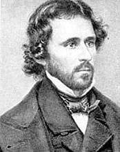
John C. Fremont. (Utah) |
The first Anglo-Americans in the region were fur trappers, most of whom specialized in the pursuit of beaver pelts. The first American that is known to have explored California was the legendary trapper Jedediah Smith, who in 1826 managed to cross the Great Basin and make his way to the San Gabriel Mission. While there, he was ordered out of the region by the Mexican governor. Smith apparently was not moved by the governor's threats, and he continued to explore the area around the San Joaquin Valley while trapping as many beaver as possible. By 1830 the Hudson's Bay Company was in the area, and as word of the region's abundance spread more trappers came. During the 1830s and 1840s, several explorers roamed the region (often illegally as in the case of Captain Fremont's Topographical Engineering mission) and discovered that crossing the Sierra Nevada Mountains was far from easy. Few exploratory missions succeeded in finding ways to get through the mountains. Most parties eventually gave up and simply took a long loop around the impasse.
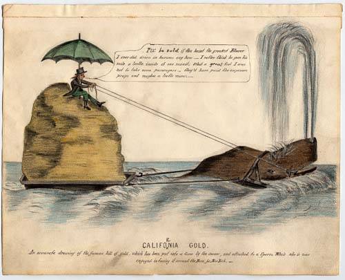 This mid-nineteenth century cartoon, that shows a man attempting to float a gold nugget from California to New York, satirizes the hopes of the gold seekers. (California) This mid-nineteenth century cartoon, that shows a man attempting to float a gold nugget from California to New York, satirizes the hopes of the gold seekers. (California)
|
California became part of the United States after the Mexican War in 1848. Around the same time, gold was discovered near Sutter's Fort (modern Sacramento). During the "Gold Rush" of the 1840s and 50s, California's populaton boomed. Most settlers brought little more than pans, pick axes, scant geologic knowledge, and what would usually prove to be vain hopes. Although most people who went west for gold never "struck it rich," the land was beautiful, game was abundant, and there were many good places to farm. The growth of the mining industry resulted in the expansion of cattle and sheep grazing into the interior valleys. Trees were often felled to make space for agricultural fields. The influx of settlers brought in three key elements besides the people themselves: Eurasian diseases, Eurasian invasive species, and the means and will to dramatically alter the landscape. These factors made it all but impossible for the Indians to survive in the area. Probably the "last straw" for the Native Americans was a drought that began in 1866. This drought caused cattle ranchers to seek pasturelands at higher elevations in the Sierra, which was where most of the Indians that survived the outbreaks of diseases had fled. Despite some violent initial encounters, most of the Indians that survived the 1850s and early 1860s seem to have accepted the fact that their way of life was over and gradually left their ancestral homes for strange lands to eventually become wards of the reservation system. The Anglo-American conquest of the area was now complete. However, the drastic changes to the land were just beginning.
At first, the ability to extract the Sierra Nevada's resources and alter the area's landscape was kept partially in check by the lack of roads suitable for wagon travel. This changed in the 1860s with the development of several "trails," which provided semi-reliable transportation routes into the region and opened up new lands in the high Sierra foothills to prospectors, hunters, shepherds, etc. Additionally, there were numerous government surveys done during this period. These surveys gave the new settlers a better idea of the local geography. The combination of the new "trails" and the discovery of gold near Mineral King led to an explosion of claim-seekers in the area during the 1870s and early 1880s. However, the mineral resources were not as abundant as everyone hoped, and the means of processing ore required cash investments, which most people lacked. Several companies were started with the cooperation of claim-holders, many of whom traded in their land claims for shares in these companies. Most of these companies ultimately went bankrupt for a variety of reasons including inadequate smelting equipment, lack of mining success, poor management, and the occasional avalanche.
After much of the land had been degraded by grazing and the largely fruitless pursuit of mineral resources, many people decided that the abundant timber in the area provided the best means of making a living. Moving the logs from the forest to the nearest navigable river was the key logistical difficulty of this enterprise. After the construction of the Mineral King Wagon Road, transporting lumber down from the mountains was possible, but still difficult. Additionally, improving steam technology gave local mills the ability to process lumber more efficiently. Yet, until the Timber and Stone Act of 1878, it was still cheaper to buy lumber brought in from the north by railroad. This act encouraged western development by allowing individuals to purchase up to 160 acres of timberland for $2.50/acre. The pace of timber harvesting increased as essentially the entire region was for sale, although both before and after this act it was common for timber to be simply taken from public lands. Much of the land that was sold under this act wound up in the hands of large corporations, as it was common for timber companies to pay private individuals to buy the land and subsequently deed it over to the company. With only Grant Grove (a four mile tract in a sea of privately owned land) being reserved from sale and timber development, it seemed that it was only a matter of time before the majority of the Giant Sequoia groves would be cut unless some serious change was made. The logging and increased grazing during the 1870s and 1880s was severe enough to alter the seasonal flow patterns of the streams running into the Central Valley. The general phenomenon of deforestation altering seasonal flow patterns is common throughout the world, yet the specific mechanics of the process are debatable. Yet, the basic connection between logging/ranching and hydrologic alterations was understood at least by the 19 th century, as the first real conflicts over timber issues in the Sierra Nevada region came not in the form of preservationists vs. loggers, but rather in the form of valley farmers vs. loggers. To a farmer, water means survival, and the environmental changes created by the extractive activities in the mountains posed a direct threat to the farmers who lived in the San Joaquin Valley. Additionally, many peoples from the lowlands enjoyed journeying to the mountains for recreation, and the visually obvious impacts of logging and the loss of forage for horses due to overgrazing, impacted the areas tourist qualities.[14]
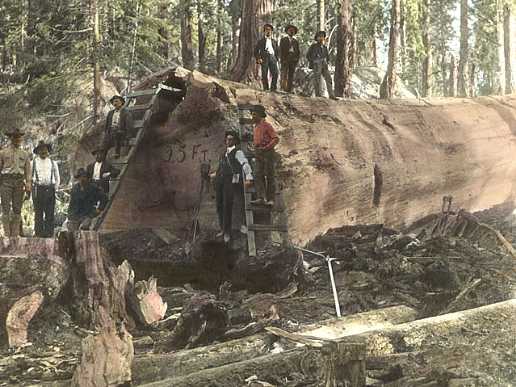
A 25 foot Giant Sequoia felled in the 1890s. (NPS)
|
BACK TO TOP
Resistance to Over-Exploitation
Although John Muir was the first person to extensively study and travel in the Giant Sequoia groves, a journalist named George Stewart became the first person to actively broadcast the concerns of the valley farmers and a new group of citizens who would come to be known as "preservationists." His first approach to the issue was to propose a ban on cutting Giant Sequoias, an idea which failed soundly. He then looked at two past precedents for preservation. The first was an 1864 act by Congress, which set aside sections of Yosemite Valley and Mariposa Grove from sale to private individuals. Congress gave the State of California the responsibility of managing this reserve. However, the State's management committee granted so many concessions to grazing and logging interests that the idea of the reserve became virtually moot. The second precedent, which would prove to be successful, involved the establishment of preserves around the thermal geysers near the head of the Yellowstone River. Since there was no state government in this area, the administration of the preserves known as Yellowstone National Park fell to the U.S. Department of the Interior. However, this agency lacked the funding to properly enforce the area's protected status. As a result, the U.S. Army was given the task of park management. In the days before the Forest Service and National Park Service, the use of the U.S. Army to enforce the protected status of federally mandated reserves would prove to be necessary. Yet, stopping grazers and loggers from making a living off of these reserves would prove analogous to the proverbial Dutch Boy trying to stop a flood by putting his fingers in the dike.
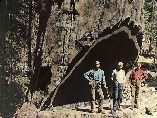 A group of loggers stand underneath the notch of a Giant Sequoia. The pervasive logging in this area was the main reason for the establishment of the parks and what were then known as forest reserves. (NPS) A group of loggers stand underneath the notch of a Giant Sequoia. The pervasive logging in this area was the main reason for the establishment of the parks and what were then known as forest reserves. (NPS)
|
The 1888 election of Republican Benjamin Harrison created a political environment that favored the return of reserved lands to public sale. To Stewart's dismay, several reserved tracts with Sequoia groves were returned to the market. However, with the support of a coalition of concerned citizens and the leadership of U.S. Representative General William Vandever, a bill was introduced to protect 76 square miles of the region's forests. The bulk of the coalition building effort came from Stewart and a man named Frank Walker. Their efforts are noteworthy as within four months the bill's supporters included a large group of valley farmers, the California Academy of Sciences, six California Newspapers, and the state's Governor. The bill protected several large Sequoia groves, protected some land from ranching activities, and stipulated that this area was intended for public enjoyment. A few ranchers provided the only opposition to the bill, which easily passed through both houses of Congress and was signed into law by President Harrison on September 25, 1890. Sequoia National Park was thus born. Administration of the park was assigned to the Secretary of the Interior, although it was the army that was responsible for enforcing the preservation mandate. This model of using the federal government to stop the development of wildlands is still the most common means of preservation in America today.
Yet, this first bill is only part of the story. As it turns out, for reasons no one is really sure of, another bill called H.R. 12187,was also introduced in 1890. Support for this bill came from a group almost completely separate from George Stewart's coalition. H.R. 12187 proposed expanding the area of Yosemite National Park by five times, and the area of Sequoia National Park by about three times. It also proposed creating a new park called General Grant National Park. Despite some grumblings about procedure, the bill passed both houses with little opposition and was signed into law by President Harrison in October of 1890. Where this bill came from and why there were no real objections to what was for the time unheard-of preservation measures is unclear. However, several historians have speculated that the powerful Southern Pacific Railroad was behind the quiet substitution. For a variety of reasons, the railroad had much to gain financially from the preservation measures. For instance, tourism would obviously be fostered by the park's creation, and tourists would need transportation from cities like San Francisco. Thus, the bill would increase Southern Pacific's passenger volume. Along the same lines, since lumber extraction would not be taking place in the park, the area's residents would need to buy timber that was shipped by the railroad. Buying timber milled elsewhere was already common practice in the area, and the railroad probably wanted to keep it that way. It is known that the company's San Francisco office had access to information about the proposed park before anyone else in California did, and even before most Congressional members knew that the bill existed. The dedication of Stewart and his coalition was important, yet in the end, corporate political maneuvering and ultimately the pursuit of profit were probably the primary drivers behind the parks' expansion.
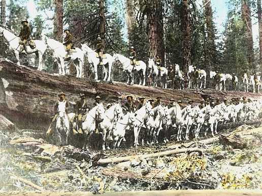 An 1895 photo of the first caretakers of the park, the Fourth U.S. Cavalry. (NPS) An 1895 photo of the first caretakers of the park, the Fourth U.S. Cavalry. (NPS)
|
John Noble, who was the Secretary of the Interior under President Harrison, was given the task of creating a management strategy based on the vague goals stated in H.R. 12187. The first set of rules outlawed hunting, fishing, timber harvesting, and the possession and use of alcohol. In the spring of 1891 the Fourth U.S. Cavalry, a group of 58 mounted soldiers, departed from San Francisco to enforce the new park boundaries. The first year for these soldiers was far from easy. A land dispute between the park and an established colony, numerous squatters, and unclear orders all hampered the soldier's ability to enforce the rules, which were not very specific to begin with. At the same time, President Harrison signed into law a bill, which contained a clause that allowed the President to set aside forest reserves. Ironically, this singularly important clause was added slightly before Congress adjourned and few members appear to have noticed its addition. In 1893, at the end of his presidency, President Harrison created several reserves including the Sierra Forest Reserve. It was generally assumed by people at the time that forest reserve and national park were synonymous, the two theoretical entities would each evolve different management goals.
BACK TO TOP
Federal Land Management Matures
Until the establishment of the Forest Service in 1905, the Sierra Forest Reserve was frequently exploited without any form of regulation by ranchers, loggers, and miners. The areas designated as national parks had better enforcement for the time being, yet the lack of penalties for those who violated the rules made the Fourth Cavalry's job difficult. In 1898, when the troops were transferred from the park during the Spanish-American War, the area was simply overrun by grazers.[14] Things changed after the war when some appropriations for general maintenance and road/trail improvements were allocated. A portion of this money was used to hire several civilians, who were responsible for enforcement during the winter months when the soldiers were absent. Over time, this group grew until the primary responsibility for enforcement was in their hands. As the number of visitors to the parks increased, controlling grazing and logging became less of a problem while stopping illegal hunting and dealing with camp sanitation developed into forefront issues. While effective management practices for the national parks seemed to be developing at a reasonable pace, respect for the federal government's sovereignty over the forest reserves was almost nonexistent, and the resources allocated to the Department of the Interior for enforcing this sovereignty proved inadequate.
Then, in 1905, the management of the forest reserves was turned over to the Department of Agriculture's Bureau of Forestry. This bureau was thereafter known as the United States Forest Service. Under the leadership of Chief Forester Gifford Pinchot and the guidance of President Theodore Roosevelt, the agency adopted the goals of promoting the "wise use" of the forest reserves. The idea of "wise use" means that federal regulation would ensure that current generations could meet their needs without impacting the ability of future generations to do the same. The Forest Service was able to gain funding for this regulation by charging fees for resource extraction and land use, something the Department of the Interior had not done. In 1907, the forest reserves were renamed the National Forests and in 1908, portions of Sierra National Forest were designated as Sequoia National Forest.[14] This period also saw another key piece of legislation known as the Antiquities Act of 1906. This act allows the president "to declare by public proclamation historic landmarks, historic and prehistoric structures, and other objects of historic or scientific interest that are situated upon the lands owned and controlled by the government of the United States of America to be national monuments." The act established penalties for actions that alter these areas. Unless the proclamation states otherwise, the agency responsible for managing these monuments is the agency that managed the area before the declaration. However, the majority of these monuments are managed by the National Park Service. In 1933, one act transferred responsibility for an assortment of 64 national monuments, military parks, battlefield sites, cemeteries and memorials from various federal agencies to the National Park Service.
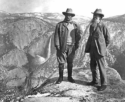 President Theodore Roosevelt (left) and John Muir (right). Both men were instrumental figures in the formation of federal land management policy around the turn of the century. However, issues like the damming of Hetch Hetchy valley highlighted the rift between advocates of "wise use" policies, such as Roosevelt and Pinchot, and preservationists like Muir. (NPS) President Theodore Roosevelt (left) and John Muir (right). Both men were instrumental figures in the formation of federal land management policy around the turn of the century. However, issues like the damming of Hetch Hetchy valley highlighted the rift between advocates of "wise use" policies, such as Roosevelt and Pinchot, and preservationists like Muir. (NPS)
|
The establishment of the National Park Service (NPS) came about largely as a response from preservationist groups like the Sierra Club to Forest Service policy. Pinchot's support for damming Hetch-Hetchy Valley highlighted the growing divide between the Forest Service's "wise use" orientation and the goal of preservation, which had defined the national parks from the beginning. By 1910, the management responsibilities for the parks had fallen into the hands of civilians and the number of parks had grown significantly. The Secretary of the Interior essentially became overwhelmed as the park superintendents reported directly to him. This system was in contrast to the efficiently operated Forest Service, and the ambitious Pinchot had actually advocated incorporating the national parks into the National Forest System. However, as it became clear that the management goals for the national forests and the national parks were different, forming another agency under the Department of the Interior seemed to be a logical idea. One of the biggest proponents of this idea was millionaire Stephen T. Mather, who would become the first director of the National Park Service. In 1915, Mather took a group of twenty-five carefully selected men to Sequoia National Park for a twelve day tour. This group included the chair of the House Appropriations Committee, the editor of National Geographic magazine, and the director of the American Museum of Natural History Mather's goal of convincing these influential men to support the formation of a preservation oriented agency apparently succeeded as the following year President Woodrow Wilson signed into law the National Park Service Act. Thereafter, the USDA Forest Service managed the National Forests and the USDOI National Park Service managed the National Parks. Shortly after the agency's inception, three key management principles for the NPS were formed under the instructions of Franklin Lane, who was Secretary of the Interior from 1913 to 1920. First, the parks were to be preserved unimpaired in perpetuity. Second, the parks were to be used only for recreation, education, and pleasure. Third, all decisions regarding public and private enterprises within the park are to conform to overriding national interests.[14] The message was clear: the parks are non-excludable public resources that are to be preserved in their natural state for the enjoyment of future generations.
Ferdinand Silcox, who was the Chief of the Forest Service from 1933-39 described the difference between the USFS and the NPS in the following manner:
"Sometimes the intrinsic values involved justify maintaining the area inviolate as a permanent "museum" piece deserving of national concern, and demand its administration exclusively as a source of scientific knowledge, education, inspiration, and recreation. In other cases the best public interest may require that the area be so managed as to derive from it a coordinated series of benefits and uses, proper balance being maintained between the intangible services of scientific, spiritual, and recreational character and the tangible service to industry, commerce, and the general economy."[6]
Having the Forest Service manage land for multiple uses and the NPS manage land solely for preservation and recreation has been the means through which maximizing the net social benefits of public lands has been sought. This management paradigm is analogous to each agency representing half of a classic balance scale. However, judging by the amount of land each agency manages and by their respective budgets, it would appear that the balance is significantly tipped toward the Forest Service. Competition over land and the inherent differences in management styles and goals both worked to create a sort of rivalry between the two agencies. Horace Albright, the first assistant director of the NPS, articulated the rivalry this way:
"Although we recognized that this (USDA Forest Service) branch was only ten years older than ours (NPS), it had acquired a reputation and a political clout through men like Theodore Roosevelt and Gifford Pinchot. If the latter had not been fired by Taft in the Ballinger-Pinchot controversy of 1910-11, the Forest Service would probably have succeeded in swallowing the national parks before our bureau could have been created. From the moment an independent Park Service was organized, the Forest Service was jealous of it and never failed to fight it whenever their land was involved. But look at it this way. For new parks (or monuments) or additions to old ones, the Park Service had few places to acquire land in the public domain unless it dipped into holdings of the Forest Service. They (the Forest Service) stood for use of anything within their borders: water, minerals, forests, and other commercially attractive enterprises. They allowed hunting, dams, summer homes, and unlimited roads for lumbering. Their beliefs contradicted all of ours…We genuinely believed we were preserving while they were destroying. The antagonism continues to this day"[6]
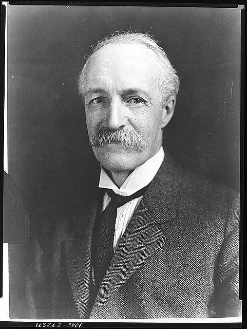 Possibly the most influential figure in the development of modern U.S. land management, Gifford Pinchot poses for an early 20 th century photograph. (SFSU) Possibly the most influential figure in the development of modern U.S. land management, Gifford Pinchot poses for an early 20 th century photograph. (SFSU)
|
Another key difference between the National Parks and the National Forests is that park rules are set by Congress, whereas the Forest Service has much more departmental discretion. Historian John Ise states:
"A giant sequoia grove in a national park for instance, must be protected unless or until Congress passed a law authorizing cutting; but such a grove in a national forest might be cut at any time if the Secretary of Agriculture and the Chief Foresters decided to do it, although it is almost inconceivable that they would do this."[6]
However, as will be elaborated upon later, this "inconceivable" idea has actually become a commonplace occurrence. There is much debate about what an optimum balance between recreation/preservation and resource extraction/land use should resemble. As power and influence have become tipped toward the Forest Service, many have argued that there has been too great an emphasis on resource extraction. For instance, in the past several decades, few national forests have actually made money on timber sales. Preparation for these sales almost always costs more money than what private timber companies end up paying the agency.[11] In other words, U.S. taxpayers are spending money to extract timber that would remain standing without the externality of federal subsidies. Between 1997 and 2004, the Forest Service spent an average of 835.5 million dollars each year on timber sale subsidies.[22] The Forest Service diffuses criticisms of these expenditures by claiming that the timber sale projects have other benefits such as "land restoration" and "fuels reduction."[20] However, whether these projects indeed benefit public lands is controversial, and even if they do, whether the benefits justify the costs is an entirely different question. Grazing is also heavily subsidized, a practice which makes it far cheaper for a rancher to graze livestock on public lands than on private.[16] Logging and grazing on public lands both produce only a fraction of the national supplies of timber (8%)[5] and livestock biomass (7%).[4] Additionally, the idea of a dichotomy between economic benefits and recreation is misleading. A study conducted by the John Muir Project, which uses data from both the Office of Management and Budget and the Forests Service, shows that timber extraction produces only about 1.5% of the total economic contributions from the National Forests. In contrast, recreation makes up about 10.2%. On the other hand, the USFS spends about twice as much promoting timber extraction (34% of its budget) as it does promoting recreation (17%). Silcox's philosophy would imply that if a tract of public land gains more money from tourism than from logging, resource extraction in this area should be stopped. Additionally, there is the idea of intrinsic value and the value that natural ecosystems have for future generations. If it makes sense from an economic standpoint to preserve an area from resource extraction and grazing, as well as from an intrinsic value standpoint, then preservation should be the favored land management objective.
BACK TO TOP
1919-1982
After both land management agencies were established, the battle over jurisdictional boundaries began. Gradually, through the use of Congressional appropriations, donations from the National Geographic Society, and Stephen Mather's own personal fortune, the NPS was able to buy the private holdings that fell within Sequoia National Park's boundaries. At the same time, the agency decided that they wanted to expand the park. This was accomplished after nearly a decade of wrangling with the Forest Service and local people who felt that their livelihood was being threatened.[14]
Although management for public enjoyment is required by the National Park Service's charter, the increase in the volume of visitors and the existence of too many impromptu campsites like these began to degrade the natural beauty of the land. (NPS) |
Probably the key dilemma for the NPS has been how to promote public recreation without impacting their parks' natural integrity. Managing potentially dangerous animals has been one issue. In the 1920s and 1930s, NPS rangers often shot or trapped bears, coyotes, and big cats. Another issue involves building structures and making land improvements on park premises. As the number of visitors coming to Sequoia National Park multiplied several times in its first few decades of existence, the policy of allowing tourists to simply camp wherever they wished created a serious problem; the human toll on the land became too diffuse and unsanitary conditions became prevalent throughout the park. (32) In response, some permanent structures, campgrounds, and sewer lines were built in order to localize the impacts. Roads would prove to be another issue. Roads affect soil structure, and even if they are some distance from the trees, can damage the shallow roots of the Giant Sequoias. The need for access to the park meant that roads would have to be built, although the impacts of these roads were to be minimized. By the early 1930s however, it became clear that the number of cars and visitors to the area was creating serious ecological impacts. Colonel John White, the park's superintendent during this period, expressed his commitment to mitigating the potential damage:
"To preserve the national park atmosphere we must curb the human desire to develop the parks quickly to compete in popularity with other resorts, or even State or other parks or national forest areas. When a new project is proposed, the first question should be, "how will it affect the park atmosphere which we desire to maintain or restore? We should boldly ask ourselves whether we want the national parks to duplicate the features and entertainments of other resorts, or whether we want them to stand for something distinct, and we hope better in our national life."
During the 1930s, Colonel White's enforcement of resource preservation became increasingly staunch, although the labor of the Civilian Conservation Corps greatly improved visitor access. White's policy of making preservation and restoration the primary concerns for any decision that affects a park's atmosphere is still in force. Since the 1970s, the NPS has become more active in what they see as restoring "natural conditions," and instead of suppressing wildfire the agency has engaged in a series of controlled burns.[14] None of these burns have grown into large wildfires, yet more time is needed to evaluate the long term success of these restoration oriented projects.
BACK TO TOP
Modern Jurisdictional Boundaries
Today, there are sixty seven geographically discrete groves where Giant Sequoias are naturally occurring. Depending on how the boundaries are defined, these groves have a total combined area of between 36,000 and 38,000 acres. Approximately one-third of the 36-38,000 total acres are managed by the National Park Service and are located in Sequoia, Kings Canyon, or Yosemite National Parks. About half of the grove acreage is located in Giant Sequoia National Monument, which is managed by the U.S. Forest Service. Most of the Giant Sequoia groves that fall under FS jurisdiction have been logged in one way or another at some point in the last one-hundred years, although Giant Sequoias larger than 30' in diameter have usually been pared. "Salvage" logging operations were common in areas that were affected by the 1955 McGee Fire. Some areas were selectively cut, although clearcuts that removed all of the trees except the large Sequoias happened frequently. The rest of the Sequoia grove acreage is distributed amongst private landholders, the BLM, the BIA, and state and county authorities. Most of the groves in this third category have also been affected by logging in the last century.[23] Overall however, more than ninety percent of the acreage is in public hands.[17]
The Forest Service accelerated its timber sales program when in 1982, without allowing for public comment, several of the groves were put up for sale. By 1986, when this matter came to the attention of the general public, 13 timber sales had been made and 7 of these projects were either completed or underway. However, the public outcry was pervasive. Between 1991 and 1999, the volume cut in Sequoia National Forest was reduced by more than 90%. In 2000, in order to give the area more permanent protection, President Bill Clinton used the Antiquities Act to carve a 328,000-acre tract out of Sequoia National Forest, which was then designated as Giant Sequoia National Monument. Yet, the proclamation has been criticized for three reasons: it left the management responsibility in the hands of the United States Forest Service; it authorized a 50% increase in logging; and it allowed standing logging operation to continue until their completion.[1]
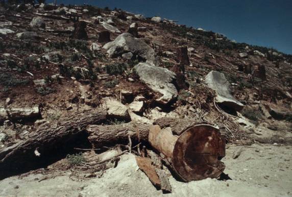
Clearcuts result in erosion and soil compaction, both of which contribute to desertification. (Litton)
|
BACK TO TOP
Current Forest Service Management
Since the Monuments establishment, the FS has continued logging in the form of "fuels reduction," "thinning," or "forest health" projects. These operations have been promoted by the 2003 Healthy Forest Initiative, which claims to be preventing wildfire, but they have been criticized for several reasons. First, fuel reduction projects are expensive. With the FS estimating that 650 million acres could benefit from some form of treatment, the costs for "restoring" our national forests could run well past 650 billion dollars. Cutting merchantable trees in order to offset some of these costs has been proposed as a solution. However, several recent FS projects still lost considerable amounts of money even though they followed this model of cutting the bigger trees, a practice known as high-grading.[7] Second, thinning operations are supposedly necessary for public safety. However, NPS studies have shown that a structure's ignition potential is almost entirely dependent upon two factors: the vegetation conditions within 40 meters of the structure, and the structure's materials.[12] It is difficult to use the public safety argument to justify the expensive "thinning" operations that remove trees that are miles away from any residence. Lastly, cutting large overstory trees through high-grading increases the area on the forest floor that is exposed to direct sunlight. When this phenomenon is combined with the accumulation of logging slash that the thinning operations produce, the area's susceptibility to higher intensity fires is thought by many to actually increase.[3]
Several environmental groups and the State of California have voiced objections to the "thinning" and "restoration" operations that the Forest Service has planned for Giant Sequoia National Monument. Since 2003, three separate lawsuits have been filed against the Forest Service, and three times the Ninth District Federal Court has granted injunctions stopping the proposed operations. The court ruled that the Forest Service violated NEPA (National Environmental Policy Act) by failing to conduct adequate environmental impact assessments and failing to allow for public comment. A key question in these cases was whether or not the thinning operations would protect the Giant Sequoias from fire. U.S. District Judge Charles Breyer ruled that the Forest Service ignored extensive research on how logging would affect the area's wildlife, and that it was doubtful the project "would still protect the forest from fire."[19]
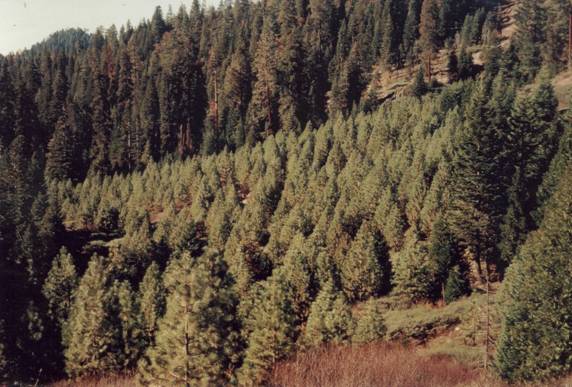 This even-age plantation lacks the age and species diversity inherent in healthy ecosystems. This even-age plantation lacks the age and species diversity inherent in healthy ecosystems.
|
While debate exists about the best way to manage the Monument, it is clear that the past century of management by the Forest Service has produced a multitude of problems. Although the Monument proclamation does not allow the Forest Service to perform commercial clear-cut operations, it has been common for such operations, which are labeled as “fuels reduction” projects, to take place right in Giant Sequoia groves. During these operations, everything but Giant Sequoias above 30' dbh (diameter at breast height) and logging slash are removed from the site. The loss of aesthetic value is but one of the problems this practice generates. Since these operations involve heavy equipment and vehicles, the shallow roots of the Giant Sequoias are easily damaged during the process. The heavy equipment can also compact the soil, which has several consequences. First, it lowers the soil's oxygen and water holding capacity. Second, soil compaction reduces the rate of water infiltration, which increases overland flow and soil erosion. This can alter seasonal flow patterns. Third, it impedes the ability of seeds to germinate and take root. Tree removal can also alter the local climate. Standing vegetation gathers dew and because of evapo-transpiration increases the amount of moisture in the air. The loss of trees in a given area can cause that area to "dry out." The confluence of these factors is believed to promote what is known as desertification. Another problem that the clear-cut operations cause is an increase in the number of "blowdowns." Since virtually all of the standing vegetation is removed during the clear-cut process, there are no windbreaks for the remaining trees. The Giant Sequoia's shallow roots and tendency to grow on slopes make them particularly unstable. Numerous examples of this "blowdown" phenomenon have been documented over the last few decades.[18]
High mortality rates have plagued the plantations that replaced the clear-cuts. The Forest Service used Ponderosa Pines for much of the replanting. Unfortunately, this species is not well adapted to the Southern Sierra Nevada Mountains. Pine Beetle infestations have also been a problem. Since most insects only feed on one type of plant, areas where there is only one species of tree (such as pine plantations) are prime breeding grounds for outbreaks. In natural ecosystems, monoculture stands are rare. This is probably because stands with too high of a concentration of any one species are the most susceptible to pests and are easily wiped out.
Conclusion
The rare and sublime nature of these trees has inspired generations of Americans. Today, their future is uncertain as the majority of these trees are in the hands of agencies with questionable management records. Conflicting management objectives and debate over the best way to administer these lands have created a whirlwind of debate. Yet, it is more difficult to question the motivations of agencies such as the National Parks Service, which is expressly committed to the preservation of the Giant Sequoia ecosystem for the sake of the ecosystem itself. Many feel that the Giant Sequoias should be managed "exclusively as a source of scientific knowledge, education, inspiration, and recreation." If passed, The Act to Save America's Forests would transfer the administrative responsibility for the Giant Sequoia National Monument from the Forest Service to the National Park Service. National Park Service lands have no clearcuts, no plantations, and are in a state more similar to the conditions that existed when Europeans first arrived in the area than the lands under the administration of the Forest Service. The National Park Service is committed to ensuring that these conditions endure into perpetuity.
Giant Sequoias grow in mixed, multi-arboreal groves. (USFS)
|
BACK TO TOP
Sources
[1] Giant Sequoia National Monument: Our Struggle to Save the "Saved." San Francisco, CA. American Land Conservancy, 2003.
[2] U.S.G.S. Earthquake Hazards Program. 2002. October 7, 2005 <http://earthquake.usgs.gov/image_Glossary/accretion.html>
[3] United States. Department of Commerce. ESA Weather Bureau. Department of Agriculture. Forest Service. A Guide for Application of Meteorological Information to Forest Fire Control Operations. Schroeder, Mark and Buck, Charles C. May 1970.
[4] U.S. Department of Agriculture, Forest Service. 2000 RPA Assessment of Forest and Range Lands. Washington, D.C., February, 2001. pg. 4. Accessed at: http://www.fs.fed.us/pl/rpa/rpaasses.pdf.
[5] U.S. Department of Agriculture, Forest Service. Forest Resources of the United States, 2002. St. Paul , MN , 2004. pg. 9. <http://www.ncrs.fs.us>
[6] United States. Department of Agriculture. Forest Service. National Monuments and the Forest Service. By Gerald W. Williams, Ph.D. July 2001.
[7] The Wilderness Society. The Economics of Fuel Treatment: Can We Afford to Thin Everywhere? Washington, DC: The Wilderness Society, 2003.
[8] Wikipedia. 2005. October 11, 2005. <http://en.wikipedia.org/wiki/Giant_Sequoia>
[9] Wikipedia. 2005. December 10, 2005. <http://en.wikipedia.org/wiki/Sierra_Nevada_forests>
[10] Baker, Herbert. "Redwood Botany." Askmar.com. March 30, 1996. October 7, 2005 <http://www.askmar.Com/Redwoods/Redwood.html>
[11] Braton, Katherine and Fosburgh, Whit. "The U.S. Forest Service." Audubon Wildlife Report 1986. Eds. Eno, Amos et al. New York: The National Audubon Society, 1986. 1-173.
[12] Cohen, Jack D. "Preventing Disaster: Home Ignitability in the Wildland-Urban Interface." nps.gov. National Park Service. 13 December, 2005 <http://www.nps.gov/fire/download/pub_pub_preventingdisaster.pdf.>
[13] Daly, Jennifer. "The Biogeography of the Giant Sequoia." College of Behavioral and Social Sciences At San Francisco State University. Ed. Dr. Barbara Holzman. Fall 2000. San Francisco State University. October 7, 2005 <http://bss.sfsu.edu/holzman/courses/Fall00Projects/Sequoia.html>
[14] Dilsaver, Lary and Tweed, William. Challenge of the Big Trees. Three Rivers, CA: Sequoia Natural History Association, 1991. <http://www.cr.nps.gov/history/online_books/dilsaver-tweed/Index.htm
[15] Farquhar, Francis P. History of the Sierra Nevada. Berkely: University of California Press, 1965. pp. 3-5, 5-8.
[16] Jacobs, Lynn. Waste of the West: Public Lands and Ranching. Arizona Lithographers: Tuscon, A.Z. 1991.
[17] Litton, Martin. Telephone Interview. April 30, 2005.
[18] Litton, Martin. Personal Interview. September 10, 2005.
[19] Margot, Ben. "Federal Judge Blocks Bush's Bid to Log Sequoias." USATODAY.com. 13 September, 2005. USA Today. 14 September, 2005. <http://usatoday.com/news/washington/2005-09-13-sequoia-logging_x.htm.
[20] Sonner, Scott. "Logging Deficits. Study: National Forest Logging Turns Green Trees to Red Ink." Earth Island Institute. 23 November, 2005. Associated Press. 13 December, 2005 <http://www.johnmuirproject.org/pdf/AP-Logging-Deficits.pdf>
[21] Stephenson, Nathan L. "Reference Conditions for Giant Sequoia Restoration: Structure, Process, and Precision." Ecological Applications: Vol. (9), No. 4, pp. 1253-65.
[22] Voss, R. Taxpayer Losses from Logging Our National Forests. The John Muir Project of Earth Island Institute: Cedar Ridge, CA. 2005.
[23] Willard, Dwight. A Guide to the Sequoia Groves of California. Yosemite National Park: Yosemite Association, 2000. |